
Rain that caused flooding across the area will move out Friday afternoon. Here’s what you can expect as the system wraps up:
STORY: Flooding, damage reported across western Pa.; more rain coming Friday
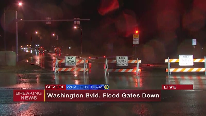
PHOTOS: Flooding, building damage reported across area
TRENDING NOW:
- Florida school shooting: What we know about the victims
- Pittsburgh teachers authorize strike
- Carnegie Mellon student accused of making 'credible threat'
- VIDEO: Former 'Survivor' contestant revived with Narcan, accused of DUI
FRIDAY (7 a.m. - 7 p.m.)
- Rain showers ending early afternoon, mixing with light snow. As of Thursday night, snow does not appear to be an issue.
- Temperatures falling from the 40s to below freezing by the Pafternoon commute.
- By 7 p.m.-9 p.m., road temperatures should fall, with a refreeze of wet roads an issue.
RIVER LEVEL FORECAST
- Charleroi: above flood stage early Saturday
- Elizabeth: above flood stage Saturday morning
- Braddock: above flood stage Saturday morning
- Pittsburgh Point: above flood stage Saturday morning
- Mon Wharf should already closed
- North Shore Riverwalk should flood Friday mid-morning, afternoon
- 10th Street Bypass should flood after lunch Friday
- Point State Park should flood after midnight Friday
- Parkway Central (Bathtub) should flood by 7 a.m. Saturday
 |
 |
 |
 |
 |
 |
Cox Media Group