An impending winter storm will bring a mixture of rain, freezing rain, ice and snow to start the weekend.
WEATHER STORY: Ice, snow threatening area to start weekend
WINTER STORM: Tracking wintry mix through western Pennsylvania
Here’s the latest timing of the storm so you know what to expect in your area and when:
Friday Morning
- Temperatures started off in the 50s and there were periods of rain into the early afternoon. Heavy rain in the early morning led to localized flooding.
Friday Afternoon (1 - 5 p.m.)
- Rain will overspread the area again, with temperatures dropping from the 50s to the 30s.
Friday Evening/Night (5 - 11:30 p.m.)
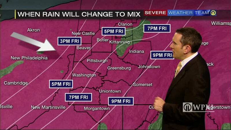
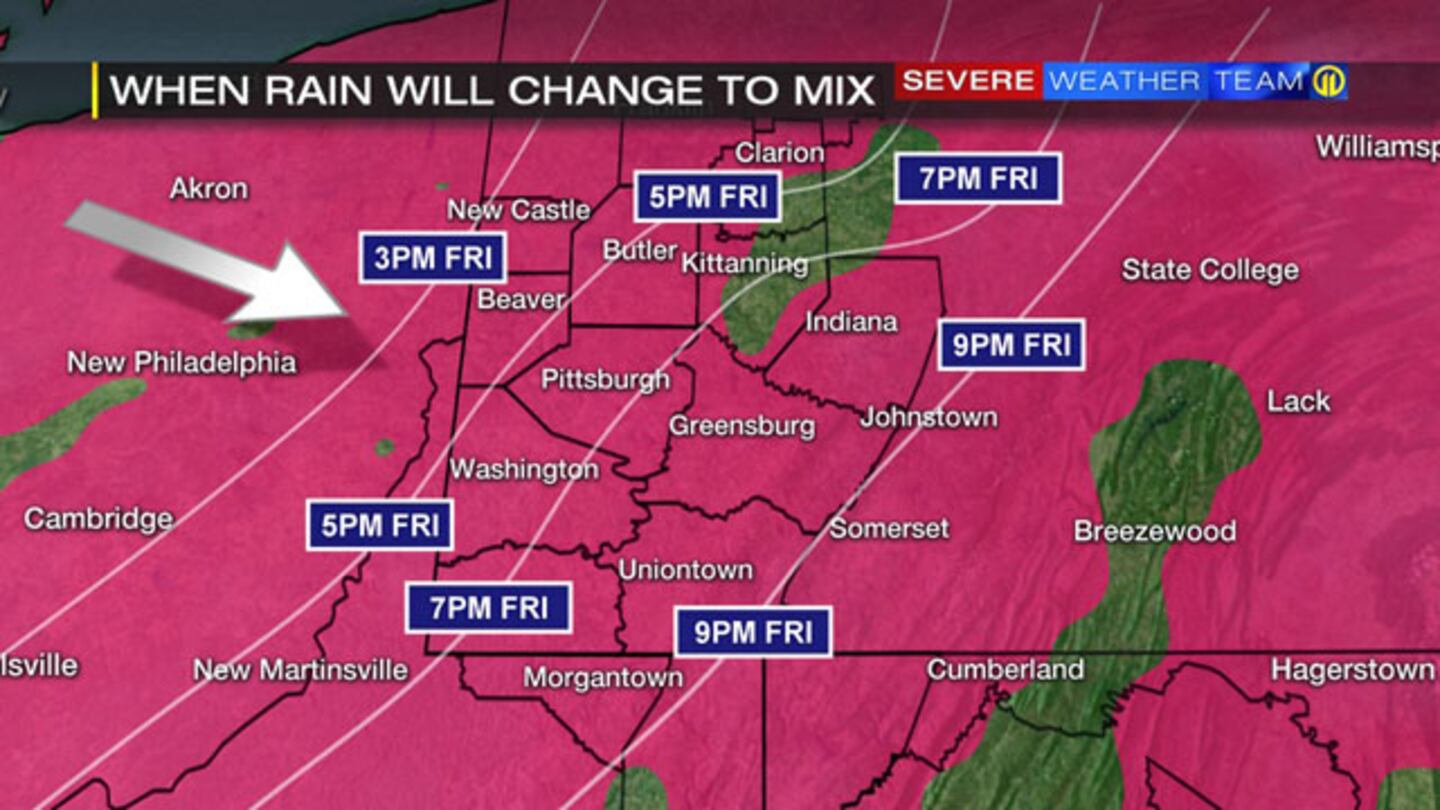
- Between 5 and 6:30 p.m., rain will start to mix with freezing rain and sleet northwest of Pittsburgh, in areas like New Castle, Grove City and Beaver. Temperatures will be in the mid-30s in Pittsburgh and near-freezing in the northwest locations.
- Between 6:30 and 10 p.m., rain will change to a wintry mix from northwest to southeast, arriving in Pittsburgh between 7 and 8 p.m.
- Between 10 and 11:30 p.m., the wintry mix will start to change to snow from Pittsburgh and northwest.
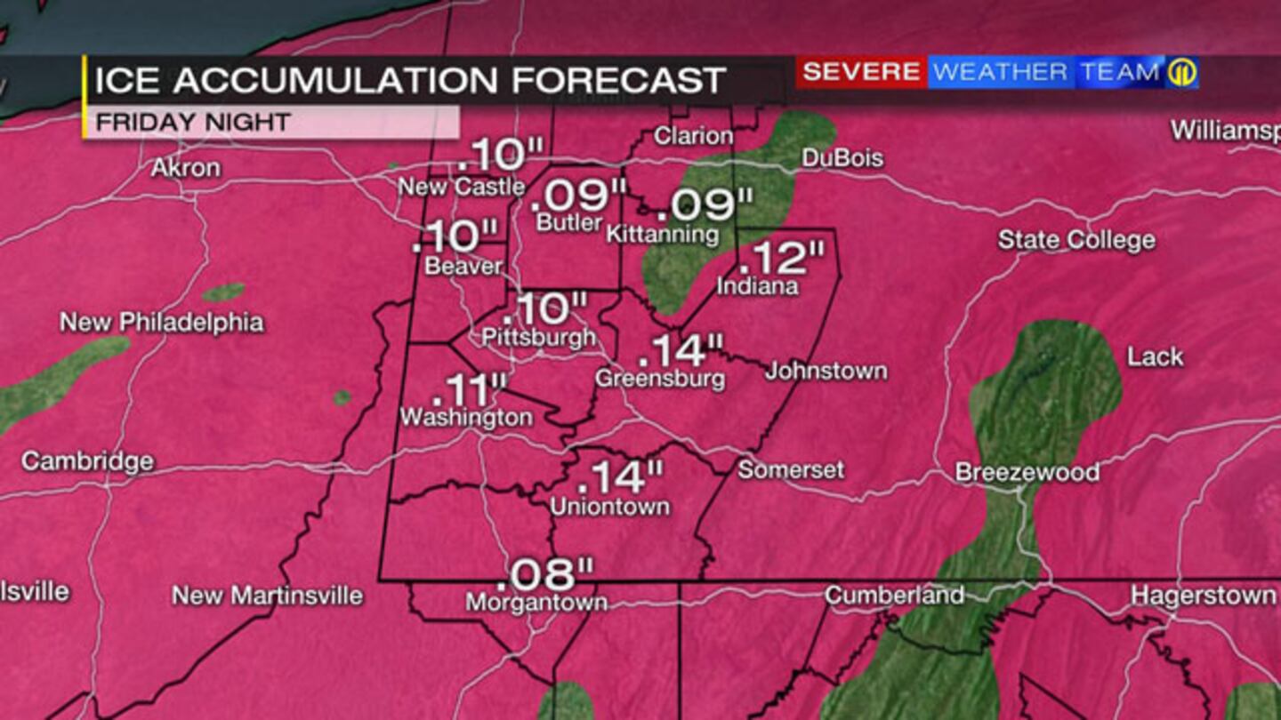
Friday Into Saturday (11:30 p.m. - 5 a.m.)
- The wintry mix will change to all snow across the area. The transition should be complete in Pittsburgh around midnight.
- Temperatures will fall into the lower 20s.
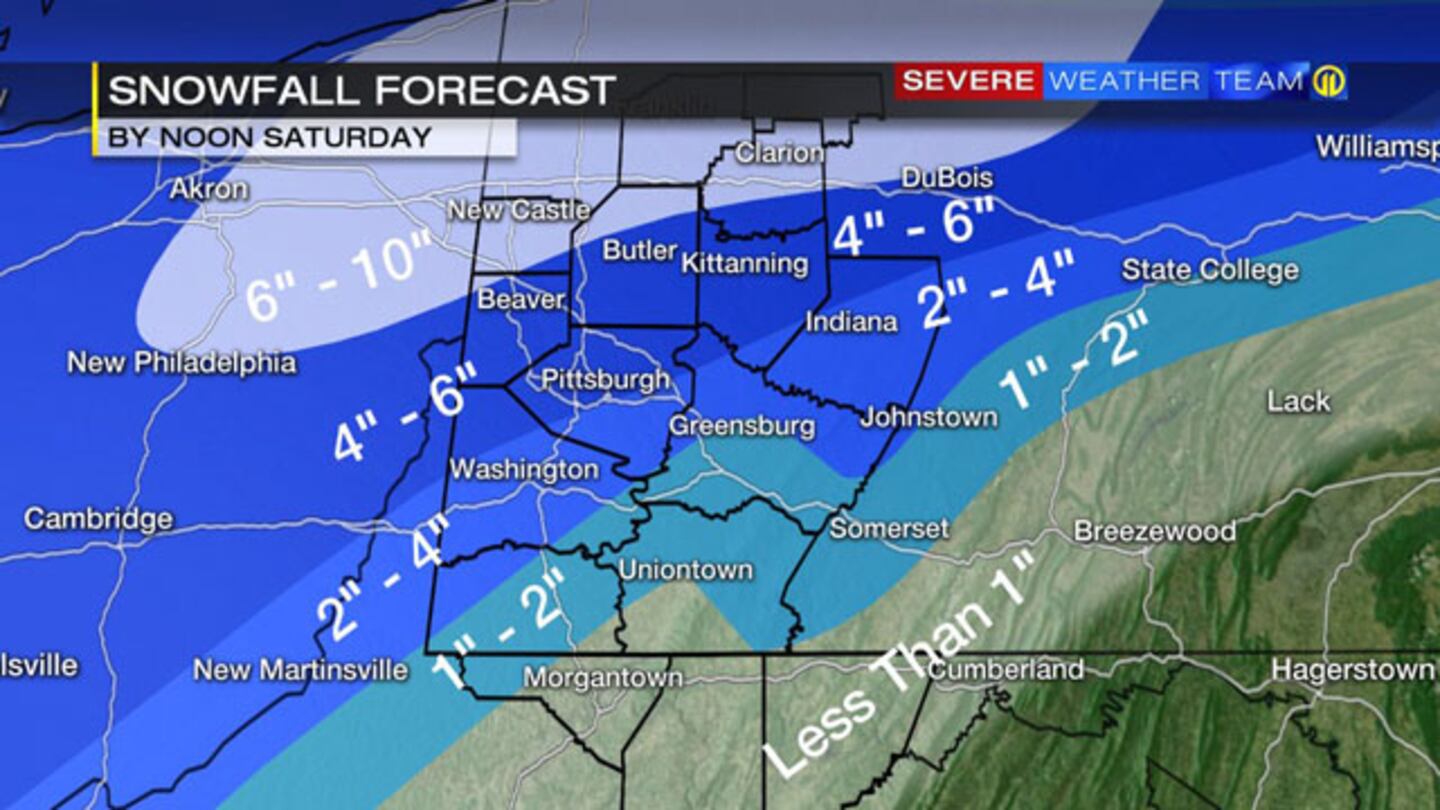
Saturday Morning
- Snow will continue to fall early in the morning, with the heaviest in northwest communities.
- Between 9 and 10 a.m., snow will wind down from southwest to northeast.
- By 11 a.m., most of the snow showers will move out of the area.
- Temperatures will be in the low 20s for much of the day Saturday. Wind chills will be in the single digits at times.
 |
 |
 |
 |
 |
 |
Cox Media Group