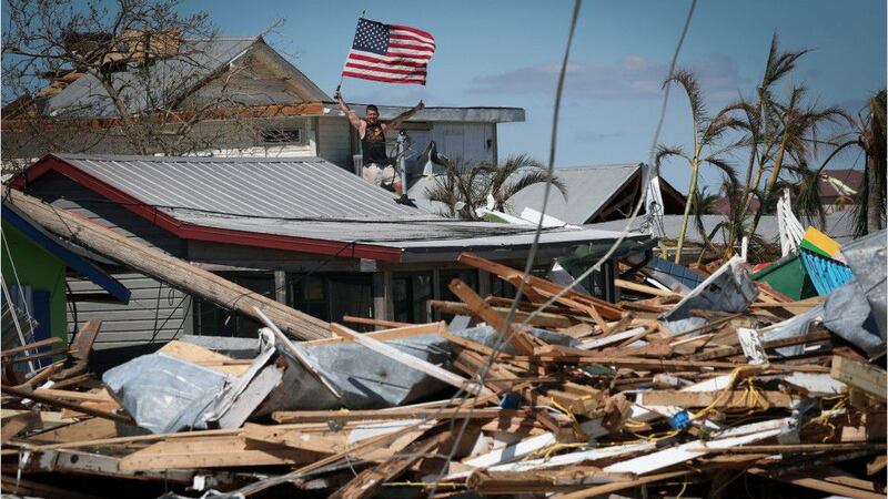
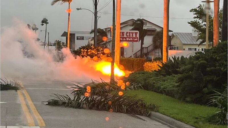
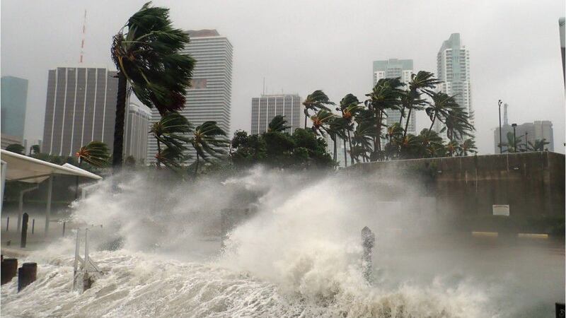
Hurricane Ian made landfall Wednesday afternoon as a powerful Category 4 storm near Cayo Costa, Florida, according to the National Hurricane Center.
Here are the latest updates for Wednesday, Sept. 28:
Hurricane Ian continues to weaken, 2 million without power
Update 11:10 p.m. EDT Sept. 28: The National Weather Service is reporting that the max sustained wind is at 90 miles per hour, dropping it to a Category 1 storm. The storm is expected to move into the Atlantic Thursday.
According to PowerOutage.us, over two million Floridians are without power.
Over 2 million electric customers are now without power in #Florida due to #HurricaneIan.
— PowerOutage.us (@PowerOutage_us) September 29, 2022
[2022-09-28 10:15 PM EDT]https://t.co/8cAFt3zGJe #PowerOutage pic.twitter.com/22uynLwbpi
Heavy rainfall continues
Update 10:20 p.m. EDT Sept. 28: The National Weather Service is reporting that heavy rainfall will continue across the Florida peninsula through Thursday. Parts of the southeast of the country could also see heavy rain later this week and through the weekend.
Ongoing heavy rainfall will spread across the Florida peninsula through Thursday and reach portions of the Southeast US later this week and this weekend. pic.twitter.com/JczJux9sYe
— National Weather Service (@NWS) September 29, 2022
Hurricane Ian weakens to a Category 2
Update 9:10 p.m. EDT Sept. 28: The National Hurricane Center is reporting that the max sustained win is at 105 miles per hour, bringing the storm back down to a Category 2.
9 PM EDT 9/28 Tropical Cyclone Update for Hurricane #Ian: A University of Florida Coastal Monitoring Program wind tower located near Punta Gorda recently reported sustained winds of 55 mph (89 km/h) with a wind gust of 78 mph (126 km/h). For more: https://t.co/tW4KeGdBFb pic.twitter.com/jvcEOYj64o
— National Hurricane Center (@NHC_Atlantic) September 29, 2022
Storm continues to weaken
Update 8:08 p.m. EDT Sept. 28: The National Hurricane Center is reporting that the max sustained wind is 115 miles per hour so the storm is continuing to weaken but is still causing rain to move through the Florida peninsula.
Hurricane #Ian Advisory 25A: Ian Continuing to Batter the Florida Peninsula With Catastrophic Storm Surge, Winds, and Flooding. https://t.co/tW4KeFW0gB
— National Hurricane Center (@NHC_Atlantic) September 28, 2022
Hurricane Ian weakened to a Category 3 storm
Update 7:30 p.m. EDT Sept. 28: The National Hurricane Center in the 7 p.m. update that Hurricane Ian has been weakened to a Category 3 storm with maximum sustained winds of 125 miles per hour. The storm is expected to weaken as it continues further inland in Florida.
7 PM EDT 9/28 Tropical Cyclone Update for Hurricane #Ian. A University of Florida Coastal Monitoring Program wind tower recently reported sustained winds of 64 mph (103 km/h) with a wind gust of 104 mph (167 km/h). For more: https://t.co/tW4KeGdBFb pic.twitter.com/Og3APw5wGE
— National Hurricane Center (@NHC_Atlantic) September 28, 2022
Virginia governor declares state of emergency
Update 6:30 p.m. EDT Sept. 28: Virginia Gov. Glenn Youngkin in a news release declared a state of emergency ahead of Hurricane Ian which is expected to hit Virginia starting on Friday.
“Hurricane Ian is a large, powerful storm, and current predictions indicate that it may impact parts of Virginia later this week into early next week,” said Gov. Youngkin in the news release. “We want to ensure that our communities have the resources needed to respond to and recover from any potential effects from the storm. While we recognize that the storm track is still uncertain, I nevertheless encourage all Virginians and visitors to make a plan, have supplies on hand, and follow official sources for the latest forecast information and guidance. Suzanne and I will be praying for those in Florida in the path of the storm.”
Gov. Youngkin is recommending that Virginians make a plan, prepare with an emergency kit and stay informed through government resources and the Virginia Department of Emergency Management on Twitter and Facebook.
North Carolina receiving storm warnings
Update 6:19 p.m. EDT Sept. 28: The National Hurricane Center has issued new warnings and watches for North and South Carolina as of the 6 p.m. EDT update as Hurricane Ian continues to storm surge on the Florida peninsula.
Hurricane #Ian Advisory 25: Ian Battering the Florida Peninsula With Catastrophic Storm Surge, Winds, and Flooding. New Watches and Warnings Issued For North and South Carolina. https://t.co/tW4KeFW0gB
— National Hurricane Center (@NHC_Atlantic) September 28, 2022
Gov. DeSantis says storm surge is the biggest concern
Update 6:15 p.m. EDT Sept. 28: In a news conference Wednesday evening, Gov. DeSantis said the storm surge and flooding are the biggest concerns from the storm.
“In some areas we think it’s hit 12 feet. It’s our meteorologists’ view that the storm has likely peaked and will be less in the coming hours,” DeSantis said.
A major disaster declaration for all 67 counties has been sent to the Biden Administration to help provide a hundred percent coverage, DeSantis said in the news conference.
DeSantis spoke with President Joe Biden on Tuesday after one of his press conferences about conditions in Florida. The White House Press secretary confirmed that interaction on Twitter.
Governor DeSantis Delivers a 5:30 P.M. Update on Hurricane Ian https://t.co/TFpacFgTt0
— Ron DeSantis (@GovRonDeSantis) September 28, 2022
Hurricane Ian hits Punta Gorda in southwest Florida
Update 5:01 p.m. EDT Sept. 28: According to the National Hurricane Center’s 5 p.m. EDT advisory, the center of Hurricane Ian made landfall again on the mainland of the Florida peninsula and was located five miles east of Punta Gorda in Charlotte County. The storm has weakened slightly but is still packing winds of 140 mph.
The storm was about 120 miles south-southwest of Orlando and moving to the north-northeast at 8 mph.
A hurricane warning is in effect for Chokoloskee to Anclote River, including Tampa Bay on the west coast of Florida, and Sebastian Inlet to the Flagler-Volusia county line on the east coast of the state. The tropical storm warning for the Florida Keys and Florida Bay has been discontinued.
The hurricane center said that if Ian maintains its current track, its center would move across Central Florida on Wednesday night and Thursday morning, with the storm emerging over the western Atlantic Ocean by Thursday morning. Ian is then expected to turn northward on Friday, the NHC said.
Hurricane #Ian Advisory 25: Ian Battering the Florida Peninsula With Catastrophic Storm Surge, Winds, and Flooding. New Watches and Warnings Issued For North and South Carolina. https://t.co/tW4KeFW0gB
— National Hurricane Center (@NHC_Atlantic) September 28, 2022
More than 1 million without power in Florida
Update 4:30 p.m. EDT Sept. 28: According to PowerOutage.us, more than 1 million customers in Florida are without power.
The website said that 1,039,877 customers were without power, including 718,991 Florida Power & Light customers. Lee County Electric Cooperative reported that 151,978 customers did not have power.
Over 1 million electric customers are now without power in #Florida after #HurricaneIan makes landfall.
— PowerOutage.us (@PowerOutage_us) September 28, 2022
[2022-09-28 4 PM EDT]https://t.co/8cAFt3AeyM #PowerOutage pic.twitter.com/sLT48b02pK
3 rescued, search for 20 continues after vessel sinks near Stock Island, Florida
Update 4:05 p.m. EDT Sept. 28: Officials with the U.S. Coast Guard said three people were rescued near Boca Chica after a vessel carrying at least 27 people sank earlier Wednesday.
Officials earlier said that four Cuban migrants swam to Stock Island after the vessel sank. Authorities continue to search for 20 people who remained missing Wednesday afternoon.
#Breaking @USCG crews rescued 3 people in the water about 2 miles south of Boca Chica. They were brought to the local hospital for symptoms of exhaustion and dehydration. Air crews are still searching. #SAR #DontTakeToTheSea
— USCGSoutheast (@USCGSoutheast) September 28, 2022
Nearly 811K without power in Florida
Update 3:40 p.m. EDT Sept. 28: The number of power outages reported in Florida jumped from about 483,000 to 810,000 after Hurricane Ian made landfall in the state on Wednesday, according to a site that tracks power outages.
More than 294,000 people in Lee County lost electricity while nearby Collier County reported upwards of 129,000 outages and Sarasota County saw nearly 113,000 outages, according to PowerOutage.us.
Hurricane Ian makes landfall
Update 3:15 p.m. EDT Sept. 28: Officials with the National Hurricane Center said Wednesday afternoon that Hurricane Ian has made landfall on the southwestern coast of Florida.
In a 3:10 p.m. update, forecasters said radar imagery indicated that the storm made landfall near Cayo Costa around 3:05 p.m. with maximum sustained winds of 150 mph.
305 PM EDT 28 Sep -- Hurricane #Ian has made landfall as an extremely dangerous Category 4 hurricane near Cayo Costa, Florida with maximum sustained winds at 150 mph. The minimum pressure from Air Force Reconnaissance Hurricane Hunters was 940 mb.
— National Hurricane Center (@NHC_Atlantic) September 28, 2022
Latest: https://t.co/tnOTyfORCw pic.twitter.com/O3agPDOZHk
23 missing after vessel sinks near Florida Keys
Update 3 p.m. EDT Sept. 28: Officials are searching for 23 people missing Wednesday after the vessel they were on sank during inclement weather near Stock Island, according to U.S. Border Patrol officials.
Chief Patrol Agent Walter Slosar said in a social media post that they responded after four Cuba migrants swam to Stock Island. Officials with the U.S. Coast Guard have launched search and rescue efforts.
#Breaking We are searching and will update as we get more information. #DontTakeToTheSea https://t.co/QPdx9HFbFd
— USCGSoutheast (@USCGSoutheast) September 28, 2022
Hurricane Ian nearing landfall
Update 2:25 p.m. EDT Sept. 28: Hurricane Ian inched closer to the Florida coastline on Wednesday ahead of an expected landfall, officials with the National Hurricane Service said.
2pm EDT 28 Sep -- Hurricane #Ian is very near the coast of southwestern Florida Peninsula.
— National Hurricane Center (@NHC_Atlantic) September 28, 2022
Maximum sustained winds remain near 155 mph with a minimum central pressure of 937 mb found by an Air Force Reserve Hurricane Hunter (@53rdWRS).
Latest: https://t.co/tnOTyg5UEw pic.twitter.com/5rhfzUltE5
Reports of power outages top 483K
Update 2:20 p.m. EDT Sept. 28: Hundreds of thousands more Floridians were without power as Hurricane Ian bared down on the state, according to a site that tracks outages nationwide.
PowerOutage.us earlier reported168,000 outages statewide. By Wednesday afternoon, the number of outages topped 483,000 reports.
Hardest hit were Lee County, where about 171,000 people lost power, and Collier County, where over 78,000 outages occurred, according to PowerOutage.us.
Ian expected to weaken after landfall, NHC says
Update 2:05 p.m. EDT Sept. 28: Hurricane Ian remained a strong Category 4 storm as it crawled toward Florida’s coast Wednesday afternoon, according to the National Hurricane Center.
In a 2 p.m. advisory, forecasters said the storm would likely make landfall “as a catastrophic hurricane soon.”
“Weakening is expected after landfall, but Ian could be near hurricane strength when it moves over the Florida East coast tomorrow, and when it approaches the northeastern Florida, Georgia and South Carolina coasts late Friday,” officials said.
Hurricane #Ian Advisory 24A: Ian Causing Catastrophic Storm Surge, Winds, and Flooding In The Florida Peninsula. https://t.co/tW4KeFW0gB
— National Hurricane Center (@NHC_Atlantic) September 28, 2022
Videos show flooded roads on Marco Island
Update 1:45 p.m. EDT Sept. 28: Police on Marco Island, a barrier island off the southwest coast of Florida, shared videos Wednesday of roads covered in feet of water brought by the approach of Hurricane Ian.
In a very short period of time Marquesas Court south of Goldenrod is now at about two and half feet of water. #mightymarcoisland #hurricaneian #marcoisland pic.twitter.com/VgrniRYLl2
— Marco Island Police Department (@MarcoIslandPD) September 28, 2022
Marquesas Court canal south of Goldenrod. #mightymarcoislaand #HurricaneIan #marcoisland pic.twitter.com/u76nzzarnd
— Marco Island Police Department (@MarcoIslandPD) September 28, 2022
Ian maintains strength as hurricane conditions spread
Update 1:15 p.m. EDT Sept. 28: Hurricane Ian continued to spin with maximum sustained winds of 155 mph on Wednesday about 35 miles west-southwest of Fort Myers, Florida, and 45 miles southwest of Punta Gorda, Florida, according to the National Hurricane Center.
1 PM EDT 9/28 Tropical Cyclone Update for Hurricane #Ian.
— National Hurricane Center (@NHC_Atlantic) September 28, 2022
The Earth Networks Station at Naples Grande Beach Resort recently reported a wind gust to 112 mph (180 km/h).
Latest: https://t.co/tnOTyfORCw pic.twitter.com/ERvk04fttd
Florida governor urges people to take shelter until storm passes
Update 1:10 p.m. EDT Sept. 28: Florida Gov. Ron DeSantis warned people to shelter indoors on Wednesday as Hurricane Ian began to make landfall on the coast.
“If you are still in Southwest Florida, just please stay inside until the storm passes,” he said. “It may appear to be calm at some point, you may just be in the eye of the storm and the backside of that will get very nasty.”
Video showed waters inundating parts of the state as Ian began to make landfall at Sanibel and Captiva islands.
Flood waters & storm surge now taken over this intersection in Sanibel, FL.
— Chandler Morgan (@Chandler_TV) September 28, 2022
30 minutes ago you could still see the ground.
This is from the city cam at Periwinkle & Casa Ybel East. @ActionNewsJax #HurricaneIan #Ian #FL #Sanibel pic.twitter.com/qbsMrycNXr
Waters flood Naples, Florida, as Hurricane Ian approaches
Update 1 p.m. EDT Sept. 28: Officials in Naples, a city in southwest Florida, warned people to shelter in place on Wednesday as Hurricane Ian caused flooding in the streets.
Videos, photos show storm surge in Florida
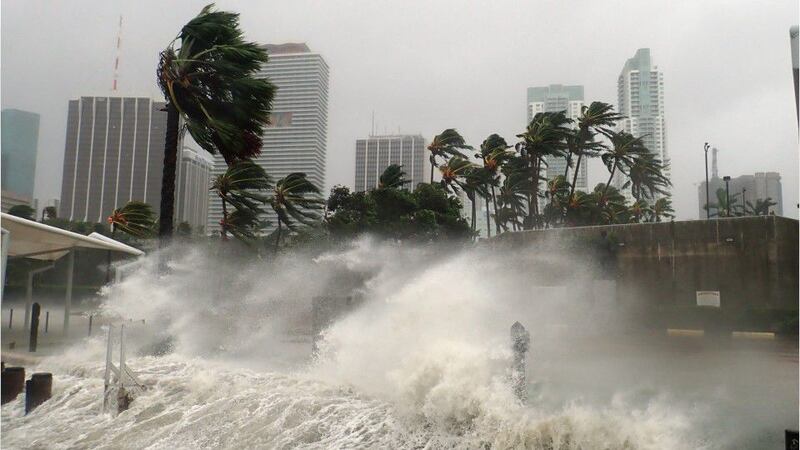
Update 12:40 p.m. EDT Sept. 28: Videos and photos posted on social media show storm surge brought by Hurricane Ian causing flooding in parts of Florida.
Storm surge rages on Fort Myers beach— this is the live cam from Pink Shell Beach Resort & Marina. Storm surge has now taken over their poolside view. @ActionNewsJax pic.twitter.com/mPIXgSCAyz
— Chandler Morgan (@Chandler_TV) September 28, 2022
Water levels at the Palatlakaha River, between Groveland and Mascotte #HurricaneIan pic.twitter.com/CFPS6G7wRG
— Christopher Heath (@CHeathWFTV) September 28, 2022
#HurricaneIan what you’re looking at is a live street cam from Sanibel Island. This is only the beginning of the devastating storm surge this hurricane will bring. You can see the water is almost as high as the mailbox. This is at Lindgren Blvd & E Gulf Dr. @CBSMiami pic.twitter.com/jjsm202e8G
— Nicole Lauren (@NLaurenTV) September 28, 2022
What to expect after a Category 4 storm makes landfall
Update 12:35 p.m. EDT Sept. 28: Officials said Hurricane Ian was moving onshore Wednesday as a strong Category 4 storm with maximum sustained winds of 155 mph.
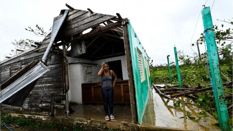
Winds of that strength are expected to cause catastrophic damage, damaging well-built framed houses, snapping trees and taking down power lines, according to the National Hurricane Center.
Water recedes ahead of Hurricane Ian’s arrival in Florida
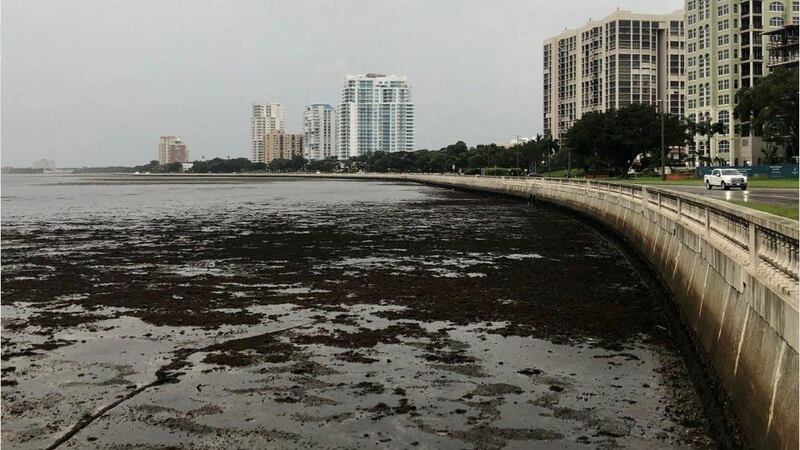
Update 12:25 p.m. EDT Sept. 28: Officials have shared images of water receding from Florida’s coasts as Hurricane Ian churns toward the state.
Eyewall of hurricane moving onshore at Sanibel and Captiva islands
Update 12:15 p.m. EDT Sept. 28: The eyewall of Hurricane Ian was moving onshore at Sanibel and Captiva islands as of 12 p.m. Wednesday, according to the National Hurricane Center.
In a 12 p.m. update, forecasters said sustained winds of 71 mph and a gust of 98 mph were recently reported near Sanibel Island. The storm continues to maintain its strength, with maximum sustained winds of 155 mph. It was spinning about 45 miles southwest of Punta Gorda, Florida, and 50 miles west-northwest of Naples, Florida, officials said.
12 PM EDT 9/28 Tropical Cyclone Update for Hurricane #Ian.
— National Hurricane Center (@NHC_Atlantic) September 28, 2022
The eyewall of Ian is now moving onshore at Sanibel & Captiva Islands.
Latest: https://t.co/tnOTyfOjMY pic.twitter.com/mQxbywROwy
Hurricane Ian ‘almost onshore,’ NHC says
Update 12:10 p.m. EDT Sept. 28: Hurricane Ian was “approaching and almost onshore of the southwest coast of Florida” at noon on Wednesday, National Hurricane Center Director Jamie Rhome said.
“You can just see this well-defined eyewall now about to move onshore into the Sanibel area,” he said in an update posted on social media.
He urged people to take shelter and stay indoors as conditions begin to deteriorate.
— National Hurricane Center (@NHC_Atlantic) September 28, 2022
Daytona Beach International Airport closing Wednesday
Update 12:05 p.m. EDT Sept. 28: Officials with Daytona Beach International Airport said they will close the airport’s terminal building and airfield beginning at 12:35 p.m. Wednesday due to the threat posed by Hurricane Ian.
“All commercial flights after this time are cancelled,” officials said. “The airfield and terminal will reopen when conditions are safe, pending weather conditions and airfield inspections.”
Hurricane Ian update
— DaytonaBeach Airport (@FlyDAB) September 28, 2022
9/28/22 - 11:45 am update pic.twitter.com/BR1ZTTjhHR
More than 2,000 flights to, from or within the U.S. have been cancelled amid Ian’s approach, according to flight tracking site FlightAware.
Florida officials warn of wastewater treatment plant ‘in danger of overflowing’
Update 12 p.m. EDT Sept. 28: Officials in Bradenton, Florida, said that public works officials have determined that the city’s wastewater treatment plant “is full and is in danger of overflowing.”
Officials asked that people conserve water.
“Don’t do dishes or laundry, flush only when necessary, limit showering, etc.,” authorities said in a social media post.
Bradenton is on the Manatee River — one of several rivers expected to see major flooding due to Hurricane Ian — south of Tampa.
Photos show water receding ahead of Hurricane Ian’s arrival
Update 11:55 a.m. EDT Sept. 28: Officials in Florida are sharing photos of water receding Wednesday as Hurricane Ian continues to approach the coast.
In a post on social media, officials with the National Weather Service’s Tampa Bay office warned people not to try to visit the coasts.
“The water WILL come back,” officials said. “Please do not attempt to walk there or any other location with receding water.”
Here are a few pictures of the receding water at Venice. IMPORTANT NOTE: The water WILL come back. Please do not attempt to walk there or any other location with receding water. https://t.co/frMvkCrvBP
— NWS Tampa Bay (@NWSTampaBay) September 28, 2022
DOWN BY THE BAY 🌊: Check out this 𝒊𝒏𝒄𝒓𝒆𝒅𝒊𝒃𝒍𝒆 view of #BayshoreBlvd taken by one our TampaPD Lieutenants! The water has receded, a clear sign that #hurricaneian is drawing near. 𝗥𝗘𝗠𝗘𝗠𝗕𝗘𝗥: Evacuations are still in effect for Zones A and B #YourTampaPD pic.twitter.com/fLhTkNuHtz
— TampaPD (@TampaPD) September 28, 2022
More Causeway Bridge in Bradenton, Manatee County. Water level uncharacteristically low. #HurricanIan pic.twitter.com/PgCAwrKEAE
— Bradenton Police (@BradentonPD) September 28, 2022
Thousands of flights delayed or cancelled as Hurricane Ian approaches Florida
Update 11:40 a.m. EDT Sept. 28: More than 2,000 flights within, going to or leaving the U.S. have been cancelled as Hurricane Ian continues to spin toward Florida’s western coast on Wednesday, according to flight tracking website FlightAware.
The site reported nearly 1,000 additional flights have been delayed.
Several airports have closed due to the threat posted by Ian. Officials with Southwest Airlines warned in a tweet that travelers should expect “continued disruptions” from Ian.
Our Network Operations Control Employees have been working around the clock to track the progress of Hurricane Ian, which is expected to cause continued disruptions as it approaches the mainland. Check your flight status and explore self-service options: https://t.co/eaI402JGFc pic.twitter.com/I6YwkGzokl
— Southwest Airlines (@SouthwestAir) September 28, 2022
Waffle House restaurants close as storm moves toward Florida
Update 11:25 a.m. EDT Sept. 28: More than a dozen Waffle House restaurants have closed ahead of Hurricane Ian’s arrival in Florida, company officials said in a statement.
The restaurants are known for staying open unless the threat of very severe weather exists.
Hurricane to make landfall near Sanibel Island
Update 11:15 a.m. EDT Sept. 28: Hurricane Ian is expected to make landfall within the hour near Sanibel Island in Lee County, WFTV reported.
11am Wednesday Ian Update: Winds holding at 155mph as Ian should make landfall near Sanibel Island within the hour. Track has been ever so slightly adjusted east in Central Florida, but Ian is so large, the track move makes no difference for our impacts. pic.twitter.com/8vYDKzgKXn
— Rusty McCranie (@RMcCranieWFTV) September 28, 2022
Eyewall of Hurricane Ian moving onshore
Update 11 a.m. EDT Sept. 28: Hurricane Ian maintained strength on Wednesday as the storm’s eyewall began to move onshore, according to the National Hurricane Center.
In an 11 a.m. advisory, forecasters said the storm was about 45 miles west-northwest of Naples, Florida, and 50 miles south-southwest of Punta Gorda, Florida. Ian had maximum sustained winds of 155 mph, just 2 mph shy of a Category 5 storm, and was moving to the north at 9 mph.
Hurricane #Ian Advisory 24: Extremely Dangerous Eyewall of Ian Moving Onshore. Ian Will Cause Catastrophic Storm Surge, Winds, and Flooding in The Florida Peninsula Soon. https://t.co/tW4KeFW0gB
— National Hurricane Center (@NHC_Atlantic) September 28, 2022
How many Category 5 hurricanes have hit the U.S.?
Update 10:45 a.m. EDT Sept. 28: Hurricane Ian was a strong Category 4 storm as it churned toward the west coast of Florida on Wednesday. Forecasters warned it could strengthen to reach land as a Category 5 storm.
Few other hurricanes of that strength have reached U.S. shores.
Biden: ‘The federal government is willing to help in every single way possible’
Update 10:35 a.m. EDT Sept. 28: President Joe Biden said hundreds of federal emergency response officials have been dispatched to help aid in the response to Hurricane Ian.
The president said he spoke to Florida Gov. Ron DeSantis and the mayors of Tampa, St. Petersburg and Clearwater to discuss federal preparations for the storm. Thousands of members of the National Guard have been activated and a search and rescue team has been deployed, Biden said. Millions of liters of water, millions of meals and hundreds of generators have been placed.
“We’ve scheduled everything we can possible do, we think,” he said. “We’ve put up shelters – they’re ready. … I made it clear to the governor and the mayors that the federal government is willing to help in every single way possible.”
Video shows start of storm surge at Florida’s Marco Island
Update 10:30 a.m. EDT Sept. 28: Video shared by officials in Marco Island, a barrier island off the southwest coast of Florida, showed high waters at Robert’s Bay as Hurricane Ian continues its approach.
Workers from more than 30 states prepped to help restore power in Florida
Update 10:20 a.m. EDT Sept. 28: People from more than 30 states have joined Florida’s power restoration workforce, which includes more than 19,000 members, said Jim Bush, the director of external affairs for Florida Power and Light.
“We have lineworkers who traveled in at this site from as far as Texas and Oklahoma, Minnesota and North Dakota, all to help respond to this challenge,” he said at a news conference in Lake City. “We’re very grateful for them for that.”
He said crews plan to work around-the-clock to restore power from 37 work bases closest to the areas expected to be hardest hit.
Governor DeSantis Meets with Linemen Ahead of Hurricane Ian https://t.co/oHuRvpkL6N
— Ron DeSantis (@GovRonDeSantis) September 28, 2022
Federal officials prepare for Hurricane Ian
Update 10:10 a.m. EDT Sept. 28: Federal emergency officials are staging in preparation of the “historic and catastrophic impacts” of Hurricane Ian, Federal Emergency Management Agency Administrator Deanne Criswell said Wednesday.
“Hurricane Ian is, and will continue to be, a very dangerous and life-threatening storm. And this is going to be for the days ahead,” she said at a news conference. “Floridians up and down the coast are already feeling the storm’s painful impacts, and we have yet to experience landfall.”
.@FEMA_Deanne reminds residents in the path of #HurricaneIan to be vigilant and heed the directions of their local officials. pic.twitter.com/YXC8X03eKr
— FEMA (@fema) September 28, 2022
168K lose power in Florida as Hurricane Ian approaches
Update 9:50 a.m. EDT Sept. 28: The number of Florida residents without power grew Wednesday as Hurricane Ian spun toward the state’s west coast, rising from about 93,000 outages to over 168,000, according to a site that tracks outages nationwide.
A majority of the outages were reported in Collier County, where more than 41,000 people were without electricity, according to PowerOutage.us. Significant outages were concentrated on Florida’s Gulf Coast.
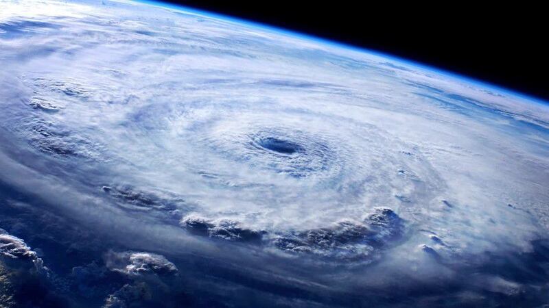
Hurricane Ian seen from space
Update 9:30 a.m. EDT Sept. 28: Video captured by cameras mounted on the International Space Station show Hurricane Ian as the massive storm churns toward Florida.
At least 12 rivers in 3 states expected to see major flooding
Update 9:25 a.m. EDT Sept. 28: At least 14 rivers are expected to see major flooding as Hurricane Ian brings tropical storm conditions to the Southeast, according to the National Weather Service.
Officials with NWS identified the rivers at risk of major flooding as Cooper River in South Carolina, Savannah River in Georgia and St. Johns River, Anclote River, Cypress Creek, Hillsborough River, Peace River, Alafia River, Little Manatee River, Manatee River, Horse Creek and Myakka River in Florida.
Life-threatening storm surge expected along southwest coast of Florida, NHC warns
Update 9:10 a.m. EDT Sept. 28: The National Hurricane Center said Wednesday morning that some areas could see as many as 18 feet of storm surge caused by Hurricane Ian.
The storm was about 60 miles west of Naples, Florida, and 70 miles southwest of Punta Gorda, Florida, at 9 a.m., according to forecasters. It maintained maximum sustained winds of 155 mph.
9 AM EDT 9/28 Tropical Cyclone Update for Hurricane #Ian -- @NHC_Surge has increased peak storm surge inundation amounts as seen in the updated text below.https://t.co/WlsRUwRrGz pic.twitter.com/aBC7DALUhc
— National Hurricane Center (@NHC_Atlantic) September 28, 2022
Storm ‘knocking on the door of a Category 5 storm,’ Florida governor says
Update 9 a.m. EDT Sept. 28: With maximum sustained winds of 155 mph, Hurricane Ian was “knocking on the door of a Category 5 storm,” Gov. Ron DeSantis said at a news conference early Wednesday.
“We expect landfall in southwest Florida later today as a major hurricane and (it) will slowly move across the central Florida peninsula before exiting the northeast Florida coast, probably sometime on Thursday,” he said.
“Much of southern Florida is already experiencing impacts from the storm as it moves closer to landfall. There have been several tornado warnings issued during the overnight hours and we expect to see that continue today.”
Hundreds of shelters have been opened for evacuating residents, and tens of thousands of residents were without power Wednesday morning.
Florida Gov. DeSantis holds news conference
Update 8:24 a.m. EDT Sept. 28: In a Wednesday morning news conference, Florida Gov. Ron DeSantis said he has asked the federal government for more resources to help with storm recovery as Hurricane Ian approaches the state, according to WFTV.
About 500 guardsmen have been activated in the state as forecasters predicted a storm surge of up to 16 feet in Charlotte Harbor and surrounding areas, WFTV reported.
Gov. DeSantis Delivers 7:30 A.M. Update on Hurricane Ian https://t.co/riwd0XzkT5
— Ron DeSantis (@GovRonDeSantis) September 28, 2022
Cuba coping with total power outage in Ian’s wake; 2 dead
Update 8:11 a.m. EDT Sept. 28: Hurricane Ian collapsed Cuba’s power grid and killed two people when it struck the country Tuesday, according to The Washington Post and The New York Times. Watch the video below to learn more:
Storm inches closer to Florida’s west coast
Update 8 a.m. EDT Sept. 28: Hurricane Ian is expected to bring “catastrophic storm surge, winds and flooding in the Florida Peninsula” beginning later today, the National Hurricane Center said Wednesday morning.
In its 8 a.m. EDT advisory, the agency said Ian, which was just shy of a Category 5 storm with maximum sustained winds of 155 mph, was about 55 miles west of Naples, Florida, and 60 miles southwest of Punta Gorda. It was moving north-northeast at 10 mph.
Hurricane #Ian Advisory 23A: Ian Expected to Cause Catastrophic Storm Surge, Winds, and Flooding in the Florida Peninsula Starting Later Today. https://t.co/tW4KeFW0gB
— National Hurricane Center (@NHC_Atlantic) September 28, 2022
Nearly 93,000 customers without power in Florida
Update 7:35 a.m. EDT Sept. 28: Nearly 93,000 customers in Florida are without power, according to a website that tracks outages.
PowerOutage.us is reporting that 92,802 customers in the state have lost power, including 23,548 in Collier County, 18,817 in Miami-Dade County, 12,584 in Lee County, 9,064 in Sarasota County, 7,807 in Broward County, 6,533 in Palm Beach County and 3,796 in Charlotte County.
Hurricane Ian just shy of Category 5 status
Update 7 a.m. EDT Sept. 28: In a special 7 a.m. EDT advisory, the National Hurricane Center confirmed that Ian has maximum sustained winds of 155 mph, just 2 mph shy of a Category 5 storm.
Sep 28 7am EDT -- Here are the key messages from the special advisory issued on Hurricane #Ian.
— National Hurricane Center (@NHC_Atlantic) September 28, 2022
Catastrophic storm surge inundation expected today as Ian moves ashore in the southwest Florida peninsula.
Latest: https://t.co/tnOTyg5UEw pic.twitter.com/cCHGT11wTF
NHC: Maximum sustained winds near 155 mph
Update 6:48 a.m. EDT Sept. 28: Ian’s maximum sustained winds have reached nearly 155 mph, just 2 mph shy of a Category 5 storm, the National Hurricane Center said Wednesday morning.
As of 6:35 a.m. EDT, the storm was about 65 miles west-southwest of Naples, Florida, and 80 miles south-southwest of Punta Gorda. It was moving north-northeast at 10 mph.
635 AM EDT 28 September -- Recent data from a @NOAA_HurrHunter aircraft indicate #Ian is rapidly intensifying & max sustained winds are now up to 155 mph.
— National Hurricane Center (@NHC_Atlantic) September 28, 2022
This information will be reflected in a special advisory to be issued by 7 AM EDT (1100 UTC).https://t.co/tnOTyfORCw pic.twitter.com/PpJtlb5KzQ
Much of Florida Peninsula under tornado watch
Update 6:30 a.m. EDT Sept. 28: Much of the Florida Peninsula is under a tornado watch, the National Weather Service said Wednesday morning.
The watch, which extends from about 45 miles southwest of Miami to 15 miles east-northeast of Orlando, will remain in effect until 5 p.m. EDT Wednesday, according to the agency.
“This tornado potential will initially be focused across the southern Peninsula early today, but is likely to further increase and spread northward into the central Florida Peninsula by late morning and afternoon,” the advisory said.
An estimated 12.3 million people, 2,389 schools and 159 hospitals are located within the watch area, the agency said.
A tornado watch has been issued for parts of Florida until 5 PM EDT pic.twitter.com/fHVWgb0I2p
— NWS Tampa Bay (@NWSTampaBay) September 28, 2022
Conditions rapidly deteriorating along southwest Florida coast
Update 6 a.m. EDT Sept. 28: Conditions are rapidly deteriorating as Hurricane Ian approaches the southwest Florida coast, the National Hurricane Center said Wednesday morning.
In its 6 a.m. EDT update statement, the agency said the Category 4 storm, which had maximum sustained winds of 140 mph, was about 55 miles west-southwest of Naples, Florida, and 85 miles south-southwest of Punta Gorda. It was moving north-northeast at 10 mph.
A buoy just north-northwest of the hurricane’s eye measured a 66 mph sustained wind and a 94 mph wind gust, the agency said. Meanwhile, a 39 mph sustained wind and 55 mph wind gust were reported near Sanibel Island.
6 AM EDT 9/28 Tropical Cyclone Update for Hurricane #Ian: Conditions rapidly deteriorating along the southwest Florida coast. pic.twitter.com/ilboCAUeEr
— National Hurricane Center (@NHC_Atlantic) September 28, 2022
Nearly 45,000 customers without power in Florida
Update 5:51 a.m. EDT Sept. 28: Nearly 45,000 customers in Florida are without power, according to a website that tracks outages.
PowerOutage.us is reporting that 44,759 customers in the state have lost power, including 19,449 in Miami-Dade County, 7,053 in Palm Beach County, 3,930 in Collier County, 3,201 in Lee County, 1,645 in Charlotte County and 1,618 in Sarasota County.
FPL is closely monitoring Hurricane Ian, and we are pre-positioning our personnel and equipment to respond quickly and safely. The Lee County Civic Center in Fort Myers is one of many staging sites we have to be able to restore service safely and as quickly as possible. pic.twitter.com/LHxLvxyA6u
— Florida Power & Light (@insideFPL) September 27, 2022
Ian upgraded to Category 4 hurricane
Update 5 a.m. EDT Sept. 28: Ian is now an “extremely dangerous” Category 4 hurricane, the National Hurricane Center said Wednesday morning.
In its 5 a.m. EDT advisory, the agency said the storm, which had maximum sustained winds of 140 mph, was about 75 miles west-southwest of Naples, Florida, and 105 miles south-southwest of Punta Gorda. It was moving north-northeast at 10 mph.
Here are the 5 AM EDT 9/28 Key Messages for Category 4 Hurricane #Ian. More info: https://t.co/tW4KeGe9uJ pic.twitter.com/pfjRjEncLC
— National Hurricane Center (@NHC_Atlantic) September 28, 2022
Rain bands spreading across southern Florida Peninsula
Update 4 a.m. EDT Sept. 28: Rain bands from Hurricane Ian are spreading across the southern Florida Peninsula, the National Hurricane Center said early Wednesday.
In its 4 a.m. EDT update statement, the agency said the Category 3 storm, which had maximum sustained winds of 120 mph, was about 85 miles west-southwest of Naples, Florida. It was moving north-northeast at 10 mph.
A buoy just north-northwest of the storm’s eye measured a sustained wind of 60 mph and a wind gust of 83 mph, the agency said. Meanwhile, a 37 mph sustained wind and 47 mph wind gust were reported near Sanibel Island.
4 AM EDT Tropical Cyclone Update for Hurricane #Ian: Rainbands from Ian spreading across the southern Florida peninsula.https://t.co/1OTHyJkqja pic.twitter.com/DIV88NW68Y
— National Hurricane Center (@NHC_Atlantic) September 28, 2022
Tropical storm-force winds reach Florida’s southeast, southwest coasts
Update 3:14 a.m. EDT Sept. 28: Tropical storm-force winds have reached the coasts of southeast and southwest Florida as Hurricane Ian continues to churn toward the state, the National Hurricane Center said early Wednesday.
In a 3 a.m. EDT update statement, the agency said the Category 3 storm, which had maximum sustained winds of 120 mph, was about 90 miles southwest of Naples, Florida. It was moving north-northeast at 10 mph.
A sustained wind of 39 mph and a wind gust of 60 mph were reported at Biscayne Bay Light, the agency said. Meanwhile, a sustained wind of 35 mph and a wind gust of 47 mph were reported at Sanibel Island.
3 AM EDT Tropical Cyclone Update for Hurricane #Ian: Tropical-storm-force winds reaching the coasts of Southeast and Southwest Florida.https://t.co/1OTHyJkqja pic.twitter.com/nrVkFnxkxX
— National Hurricane Center (@NHC_Atlantic) September 28, 2022
Ian moves closer to Florida’s west coast
Update 2:14 a.m. EDT Sept. 28: Hurricane Ian is moving closer to Florida’s west coast, the National Hurricane Center said early Wednesday.
In its 2 a.m. EDT advisory, the agency said the Category 3 storm, which had maximum sustained winds of 120 mph, was about 95 miles southwest of Naples, Florida. It was moving north-northeast at 10 mph.
Hurricane #Ian Advisory 21A: Ian Moving Closer to the West Coast of Florida. Expected to Cause Life-Threatening Storm Surge, Catastrophic Winds and Flooding in the Florida Peninsula. https://t.co/tW4KeFW0gB
— National Hurricane Center (@NHC_Atlantic) September 28, 2022
Ian producing storm surge flooding across lower Florida Keys
Update 1:35 a.m. EDT Sept. 28: Hurricane Ian is producing storm surge flooding across the lower Florida Keys, the National Hurricane Center said early Wednesday.
In its 1 a.m. EDT update statement, the agency said the Category 3 storm, which had maximum sustained winds of 120 mph, was about 105 miles southwest of Naples, Florida. It was moving north-northeast at 10 mph.
“The National Ocean Service tide gauge at Key West measured a peak water level of about 2.5 feet above Mean Higher High Water during the past couple of hours,” the agency said.
Meanwhile, a buoy west of the hurricane’s center reported a sustained wind of 63 mph and a gust of 89 mph, according to the statement. Additionally, a sustained wind of 66 mph and a gust of 97 mph were reported at Smith Shoal Light.
1 AM EDT 9/28 Update: #Ian producing storm surge flooding across the lower Florida Keys. More info: https://t.co/tW4KeFW0gB pic.twitter.com/VDwSeLgTgx
— National Hurricane Center (@NHC_Atlantic) September 28, 2022
Ian expected to cause ‘life-threatening’ storm surge in Florida, officials say
Update 12:34 a.m. EDT Sept. 28: Hurricane Ian is expected to cause a life-threatening storm surge, catastrophic winds and flooding in the Florida Peninsula, the National Hurricane Center said early Wednesday.
Hurricane #Ian Advisory 21: Ian Expected to Cause Life-Threatening Storm Surge, Catastrophic Winds and Flooding in the Florida Peninsula. Storm Surge Warning Issued For the Lower Florida Keys. https://t.co/tW4KeFW0gB
— National Hurricane Center (@NHC_Atlantic) September 28, 2022
In its 12:30 a.m. EDT advisory, the agency said the Category 3 storm, which had maximum sustained winds of 120 mph, was about 100 miles southwest of Naples, Florida. It was moving north-northeast at 10 mph.
Here are the 11 PM EDT 9/27 Key Messages for Hurricane #Ian. Conditions are expected to continue to deteriorate across central and south Florida tonight. pic.twitter.com/u7rBXatfoH
— National Hurricane Center (@NHC_Atlantic) September 28, 2022
A storm surge warning has been issued for the lower Florida Keys from Big Pine Key westward to Key West, the agency said.
12 AM EDT 9/28 Update: Storm Surge Warning issued for the Lower Florida Keys. #Ian More info: https://t.co/tW4KeFW0gB pic.twitter.com/5qZOXWdZCL
— National Hurricane Center (@NHC_Atlantic) September 28, 2022
– The Associated Press, WFTV.com and ActionNewsJax.com contributed to this report.
©2022 Cox Media Group
